The Tornado Machine – June 28, 2018
June 28, 2018
The spring of 2018 had been a pretty good year for chasing storms across the Northern Plains. I had seen some impressive structure, powerful lightning, and gorgeous sunsets. But at the end of June the season was starting to draw to a close, and I still had yet to capture a time lapse clip of a tornado that I needed to finish up a film I was working on. Unlike many other chase days, the June 28th setup showed itself on weather models a full week in advance. The extreme instability, strong wind shear, and 70° dew points all at the same time simply does not occur often this far north. The Storm Prediction Center issued a moderate risk. I knew I needed to do everything I could to clear my schedule and chase this day.
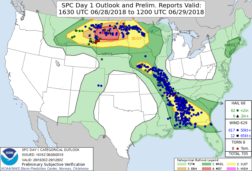
My target was Baker, Montana. I arrived there at 1PM which was perhaps too early, but I’ve learned it’s always better to be early than late. I fully expected to be chasing in North Dakota later on. But it didn’t feel right jumping on the early storms that formed there, before the atmosphere was primed. I grew restless waiting around, wondering if I made the right call and how long I should stay put. But at 5PM, a weak cell near Broadus showed signs on radar that it was strengthening. It was moving northeast into a potent environment. Finally I hit the road and headed south to Ekalaka.
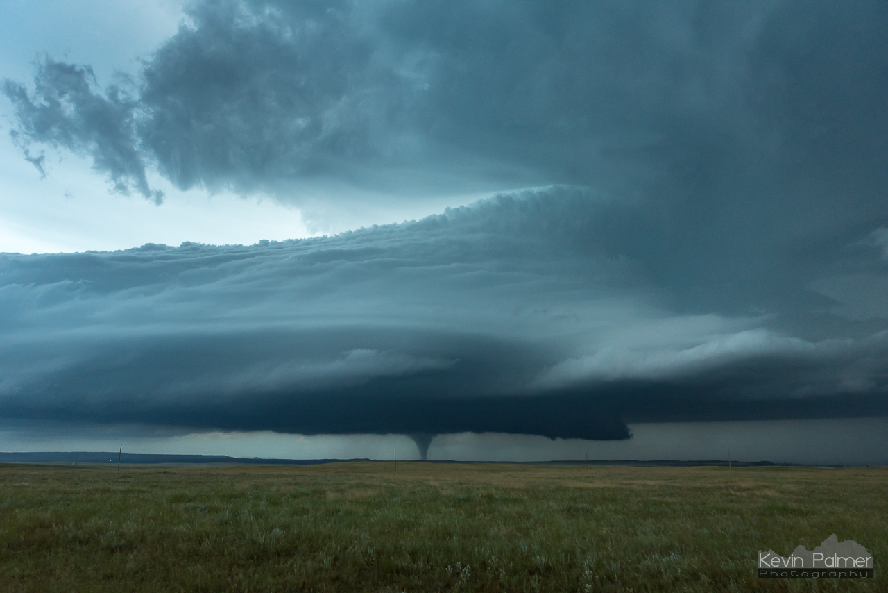
The ominous structure was visible from a long ways off. It looked like a giant curling wave, with the base scraping the ground. I saw features I had never seen before, including Kelvin-Helmholtz waves and a giant shear funnel disconnected from the main storm. But I was unable to capture those as I kept moving closer. Eventually I reached a junction and had to make a decision. Do I continue moving towards the storm in Montana and risk getting trapped on dirt roads? Or do I head east into South Dakota to get ahead of the storm? I chose the latter, and as a result I missed the first 4 twisters in Montana. But I don’t think it would have been possible to see everything anyway.

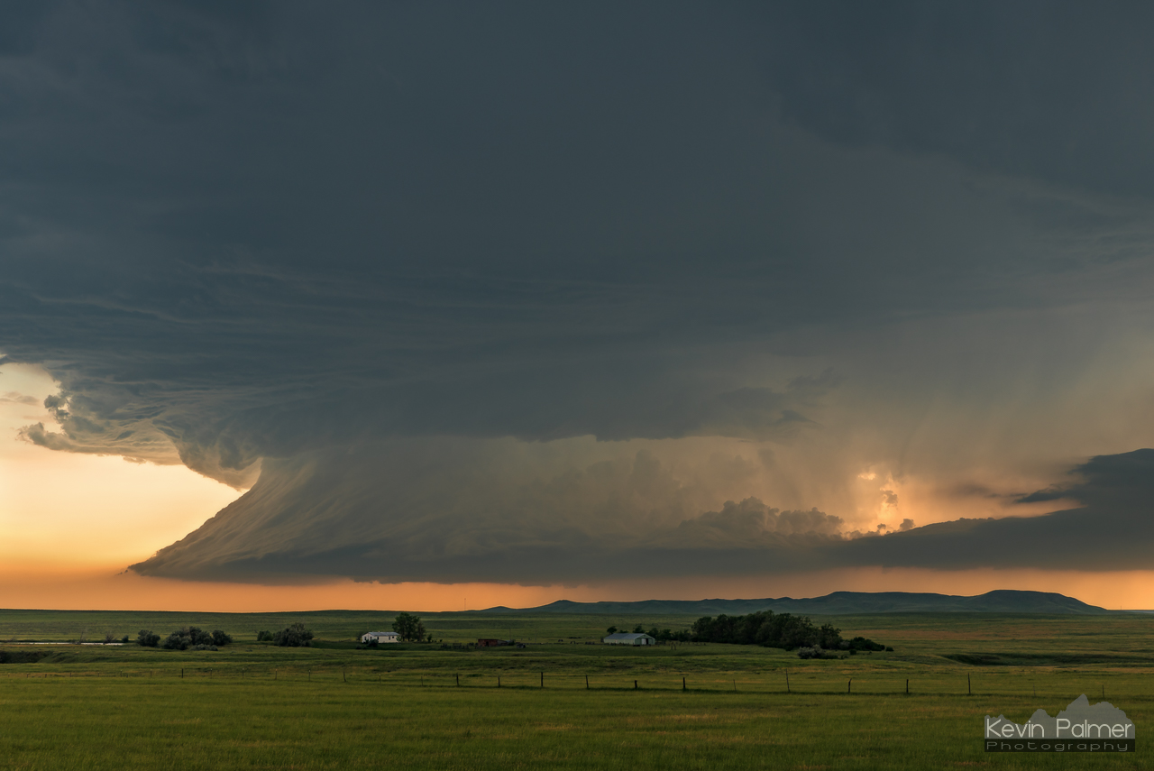
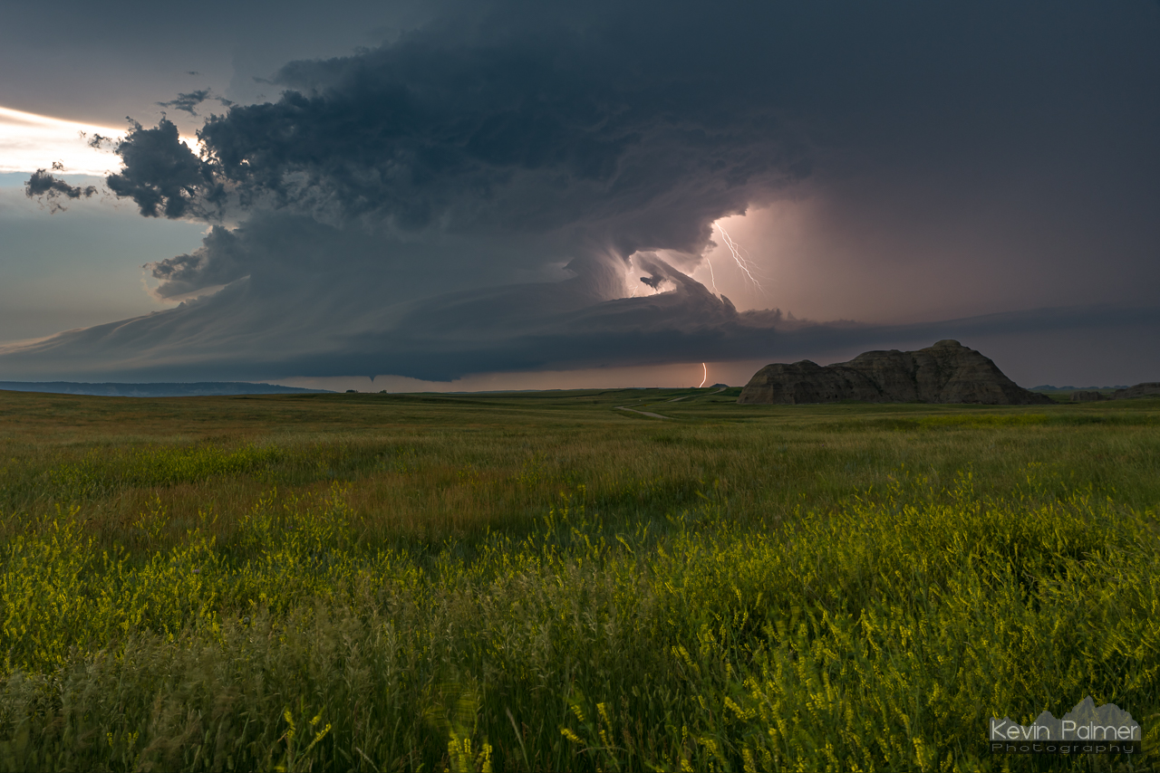
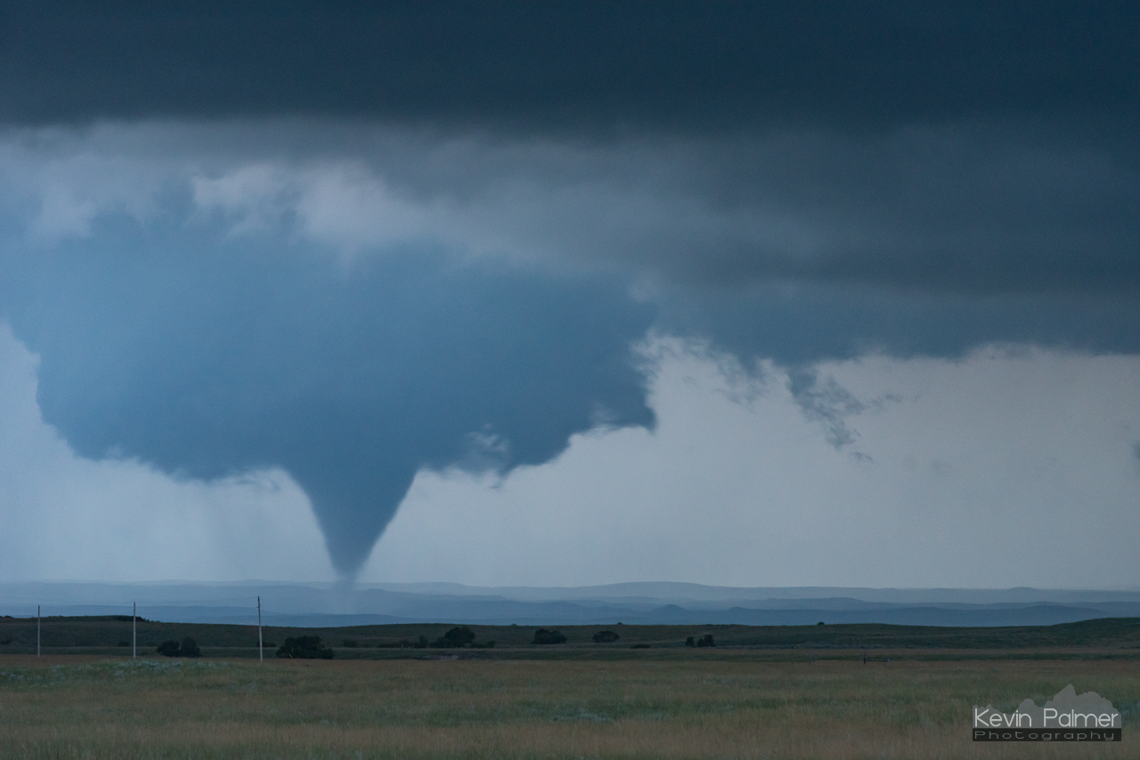
Mammatus clouds bubbled overhead at the state line. But then rain began to fall and obscure the base. I passed through the town of Buffalo where powerful cloud-to-ground lightning bolts were striking, before heading south a few miles to a scenic prairie road. Now I just needed to wait. As the cell moved northeast, the rain shaft should move out of my way and let me see the tornado that I knew was on the ground based on radar. I had never seen a supercell spin like this, right before my eyes. It looked like it belonged on another planet. Finally there it was, a cone tornado about 8 miles away. I didn’t know at the time that this was the strongest twister of the day, an EF-3. It destroyed a few ranch buildings, and threw a 5-ton tractor into another state, but thankfully no one was injured.

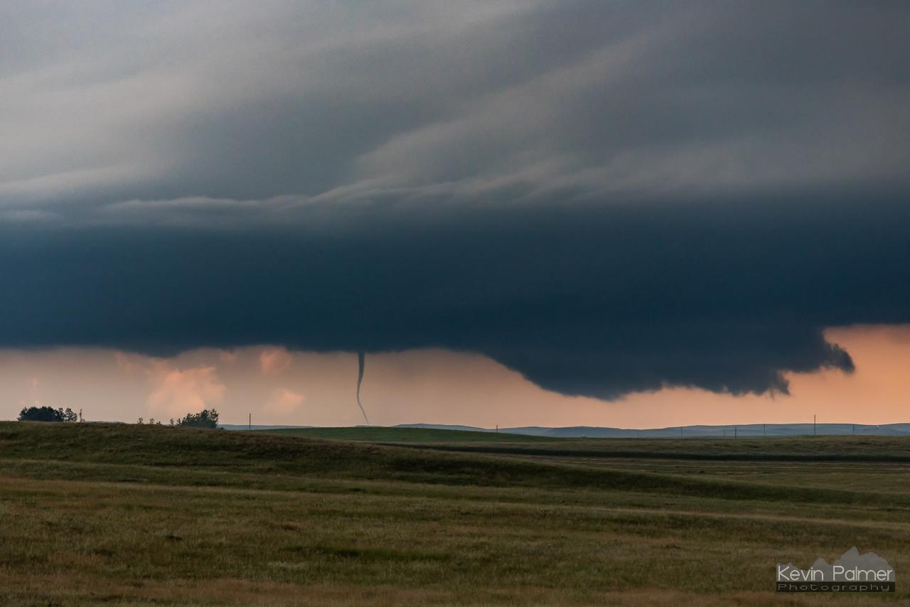
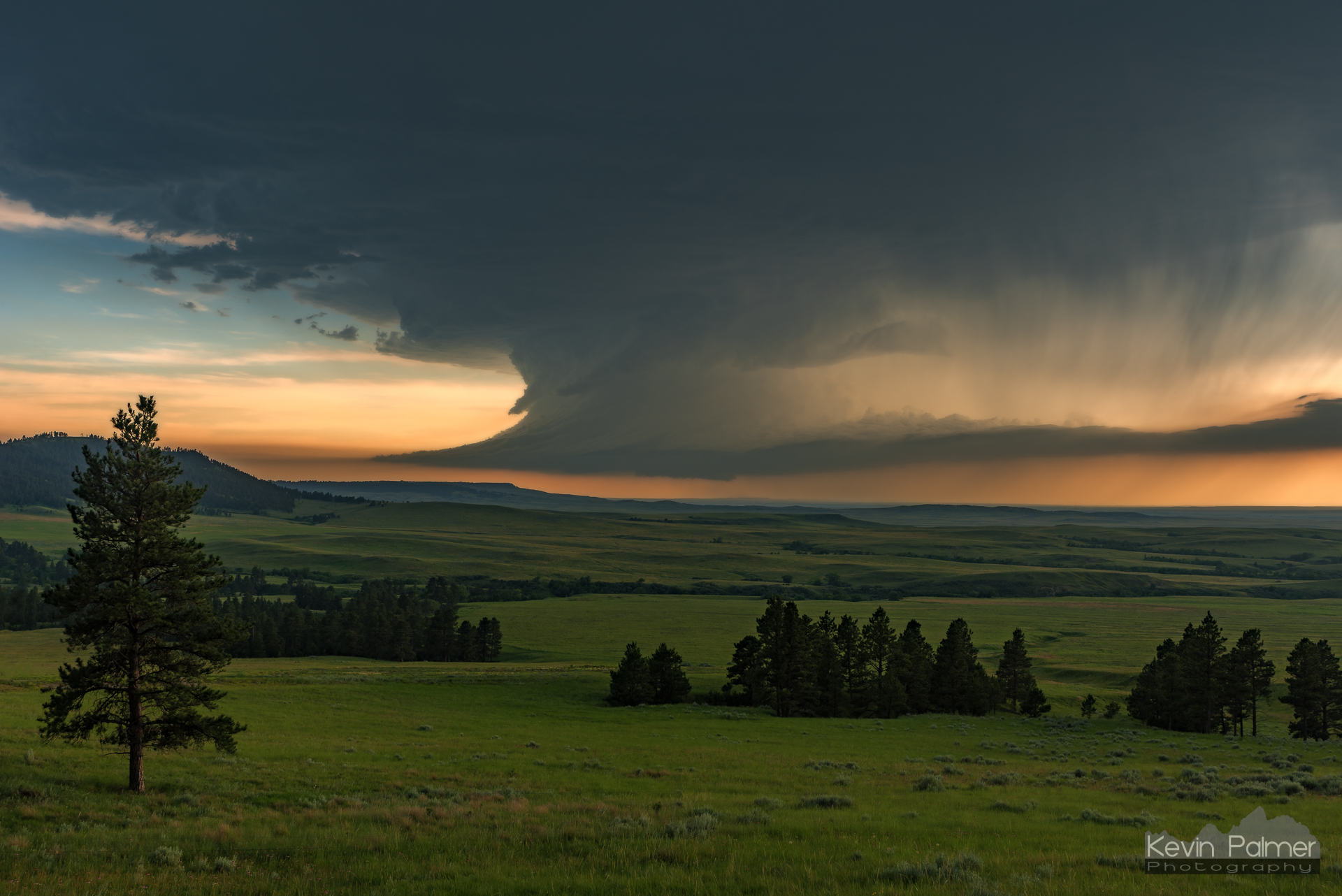
Just 3 minutes after spotting the 1st twister, it lifted. Then a skinny funnel descended and danced around, touching the ground briefly. A larger wall cloud was forming again to the right. That’s when I moved in closer. While driving, a wedge-shaped tornado formed, but my views were obscured by hills. Finally I got a clear view and stopped to shoot my 3rd time lapse of the day. The sun had set and it was getting dark so I had to shoot at a higher ISO. The overall storm structure and rapid movement was just incredible. Eventually this twister roped out, but yet another wall cloud formed in it’s place.
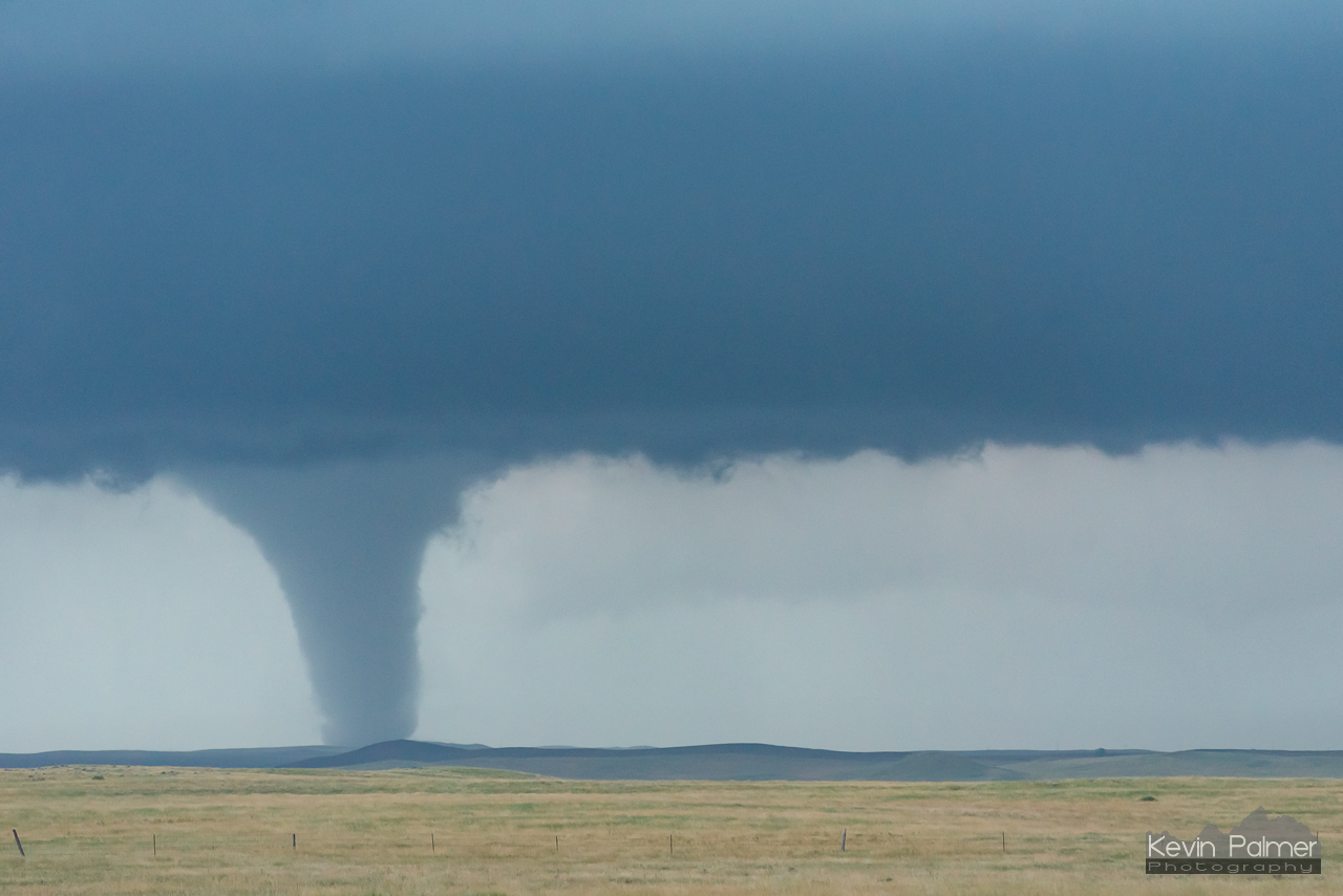
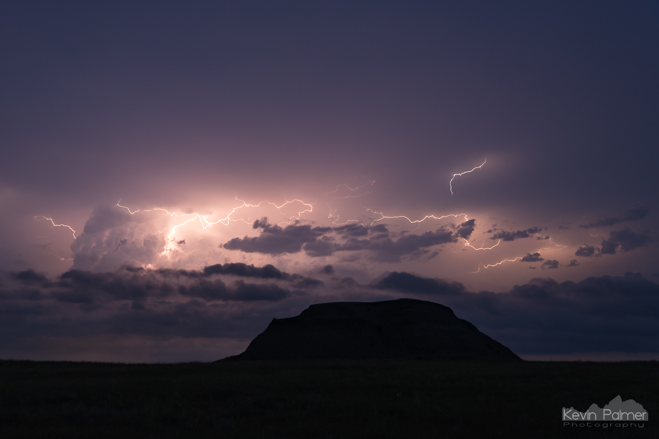
Another tube dropped from the clouds, which was the 4th tornado I witnessed that day. It was 9:15 at this point, and it slowly faded into the darkness. I tried to capture one of the frequent bolts next to the last tornado, but had no luck. The lingering lightning made it hard to call it quits. But I finally rolled into Belle Fourche, where I spent the night. It was a day I won’t forget, and the season couldn’t have ended on a better note. I couldn’t find any stats about how often a single supercell has produced 8 tornadoes, but suffice it to say that storms like this one are exceedingly rare. To see some of these scenes in motion, check out my time lapse film, ‘Upslope Flow.’
I was glad I could contribute images and information to the NWS storm survey: https://www.weather.gov/unr/2018-06-28