Rim to River to Rim – Grand Canyon in a Day
April 18, 2018
“Warning – Hiking to the river and back in one day is not recommended due to long distance, extreme temperature changes, and an approximately 5,000-foot (1,500 m) elevation change each way. If you think you have the fitness and expertise to attempt this extremely strenuous hike, please seek the advice of a park ranger at the Backcountry Information Center. Know how to rescue yourself. YOU are responsible for your safety and the safety of your family and friends. Rescue is not guaranteed, and assistance may take hours or days due to weather or other emergencies.” – National Park Service
Yes, the park service advises against it. And it is certainly not a hike to be taken lightly. But with the proper planning, gear, and fitness level, it is possible to hike to the Colorado River and back in one day. I would never attempt it during the summer, although some people are adapted to the heat better than others. In the winter, snow and ice will slow you down, and shorter days allow less time for hiking. This leaves spring and fall as the best time to attempt this very long dayhike. I went in the middle of April. I would have preferred to spend a night at the bottom of the canyon, which would have made the experience more enjoyable. But this requires a backcountry permit, or a reservation at the Phantom Ranch; both of which must be secured months in advance. So if you visit the Grand Canyon on short notice, or are bad at advanced planning like me, then a dayhike is your only option to see the bottom of the canyon.
Why would you want to see the bottom of the Grand Canyon? There are quite a few reasons. The vast majority of visitors only see this amazing natural wonder from the rim. And that view is certainly spectacular. But it’s impossible to fully appreciate the size and depth of the canyon, until you’ve seen it from within. From most of the overlooks, you can’t even see the Colorado River, because it’s so deep, and there are too many layers. Seeing the stunning turquoise-blue color of the river, and hearing the sound of the powerful rapids cannot be done from afar. It’s also amazing seeing the terrain and flora quickly change from pine forests, to juniper trees, to cacti.
Necessary Gear:
- A detailed map
- A roomy backpack
- Sun protection: sunscreen, and/or a wide-brimmed hat
- Comfortable hiking shoes (that are already worn-in)
- Lightweight, breathable hiking clothes
- Jacket/fleece
- First-aid kit
- Lunch and high energy snacks
- 2 liters of water (refill water in the canyon)
- Water filter
- Headlamp (in case you get back late)
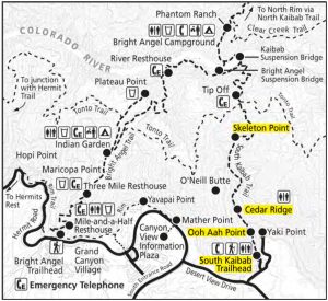
There are several routes one can take to descend into the canyon from the South Rim. But the shortest, and best maintained trails are the South Kaibab, and Bright Angel trails. By hiking both, you can make a sort of loop, without having to backtrack and hike the same trail twice. It is usually recommended to descend the South Kaibab Trail, and ascend the Bright Angel Trail. The South Kaibab Trail has no shade, and no water sources, so it is best hiked in the early morning before it gets too hot. The trailhead is away from the visitor center and other park services, and is best reached by shuttle. The park service operates the Hiker Express Shuttle Bus, which starts early in the morning for convenience. By ending your hike at the Bright Angel Trailhead, you’ll be close to the food court and restaurants. Trust me, you will be hungry when you get back to the top.

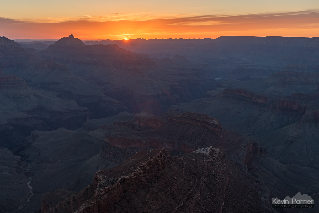
I parked near the backcountry office, and took one of the first buses to the trailhead. After watching the sun rise from the rim, I started hiking at 7:20. The temperature was 28°F and breezy, so wearing a warm fleece was necessary. The trail immediately starts off steep, with quite a few switchbacks. The early morning light really brought out all the colors and textures of the canyon. It didn’t take long to reach the scenic O’Neill Butte. The trail continues down Cedar Ridge with great views on both sides. Once past Skeleton Point, the trail once again becomes very steep with a series of switchbacks.
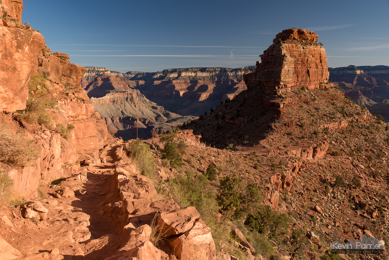
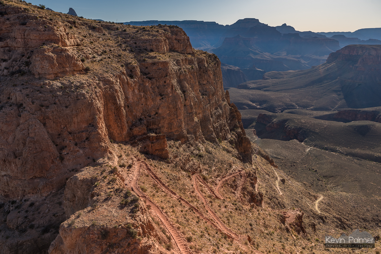
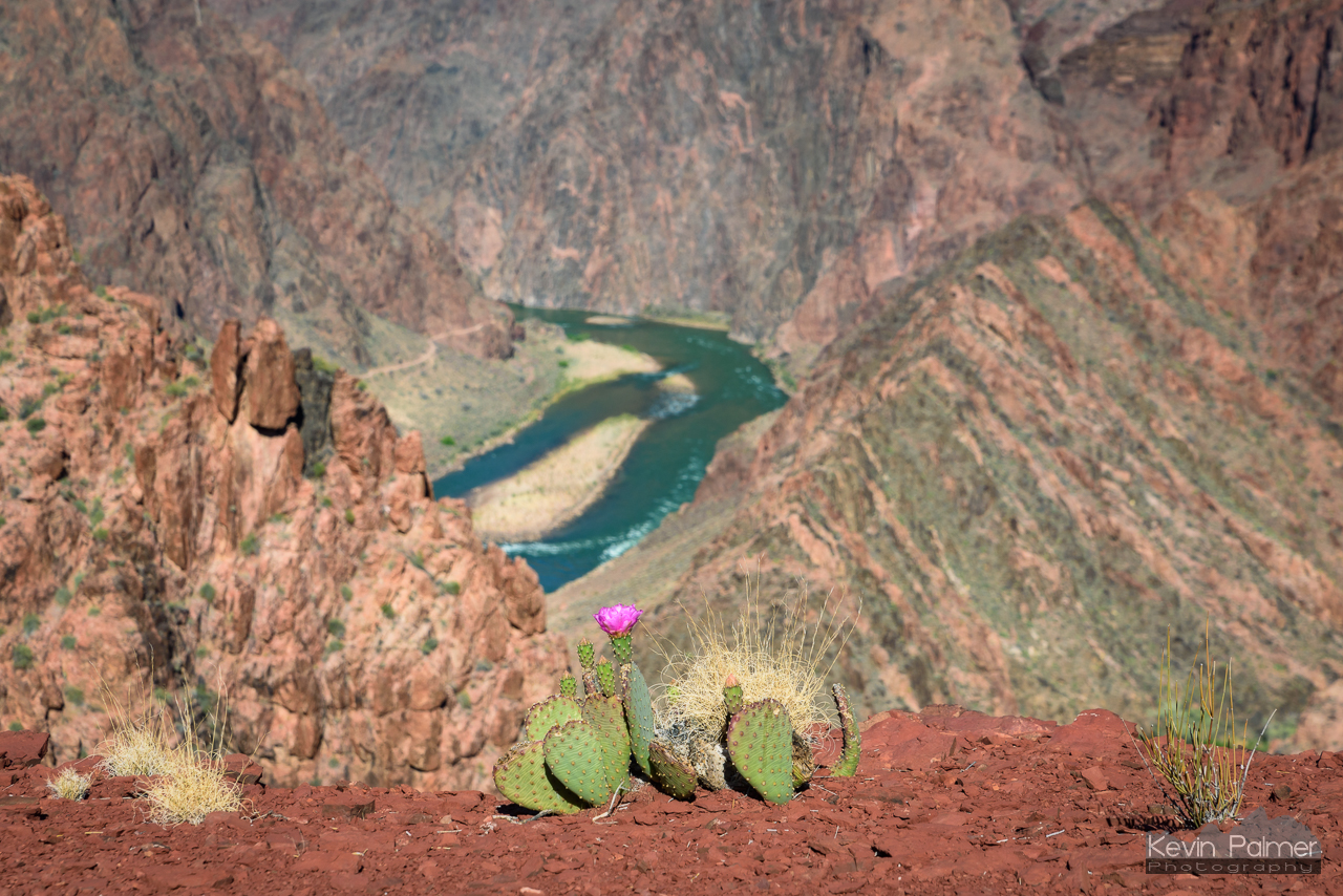
At the Tip Off area, I started to see a lot more desert plants such as yucca and prickly pear. Mid-morning was the most pleasant time to hike. It was no longer cold and not yet hot. There weren’t many others on the trail. After Tip Off, the first view of the Colorado River appeared below.
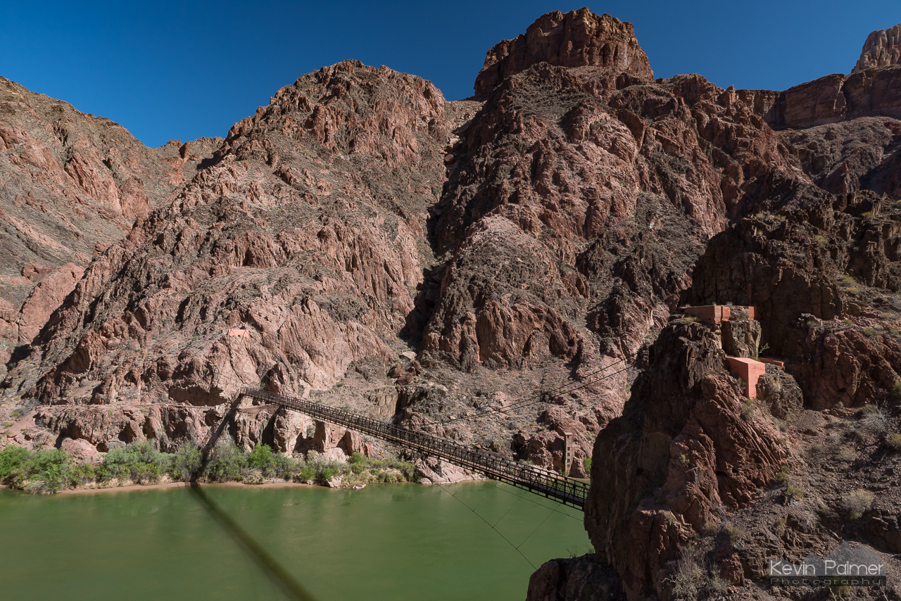
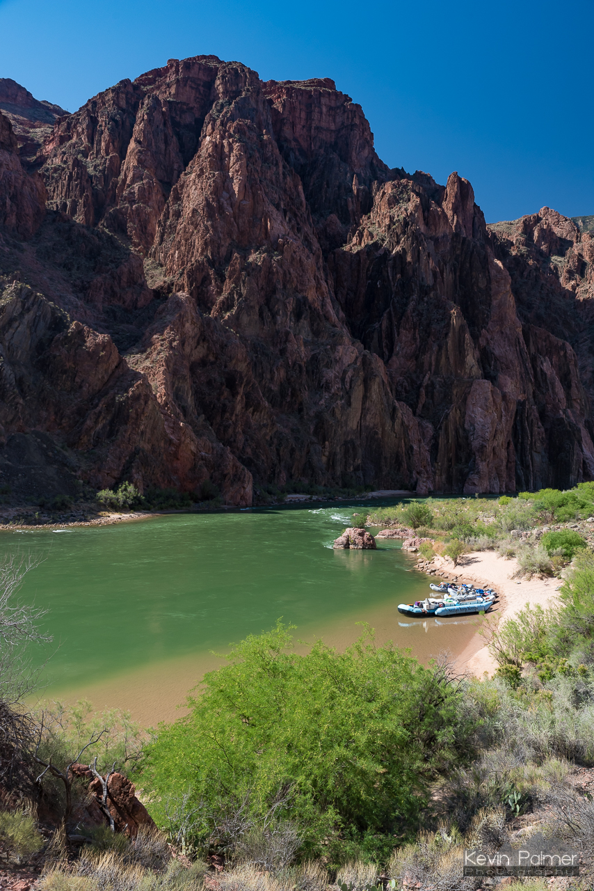
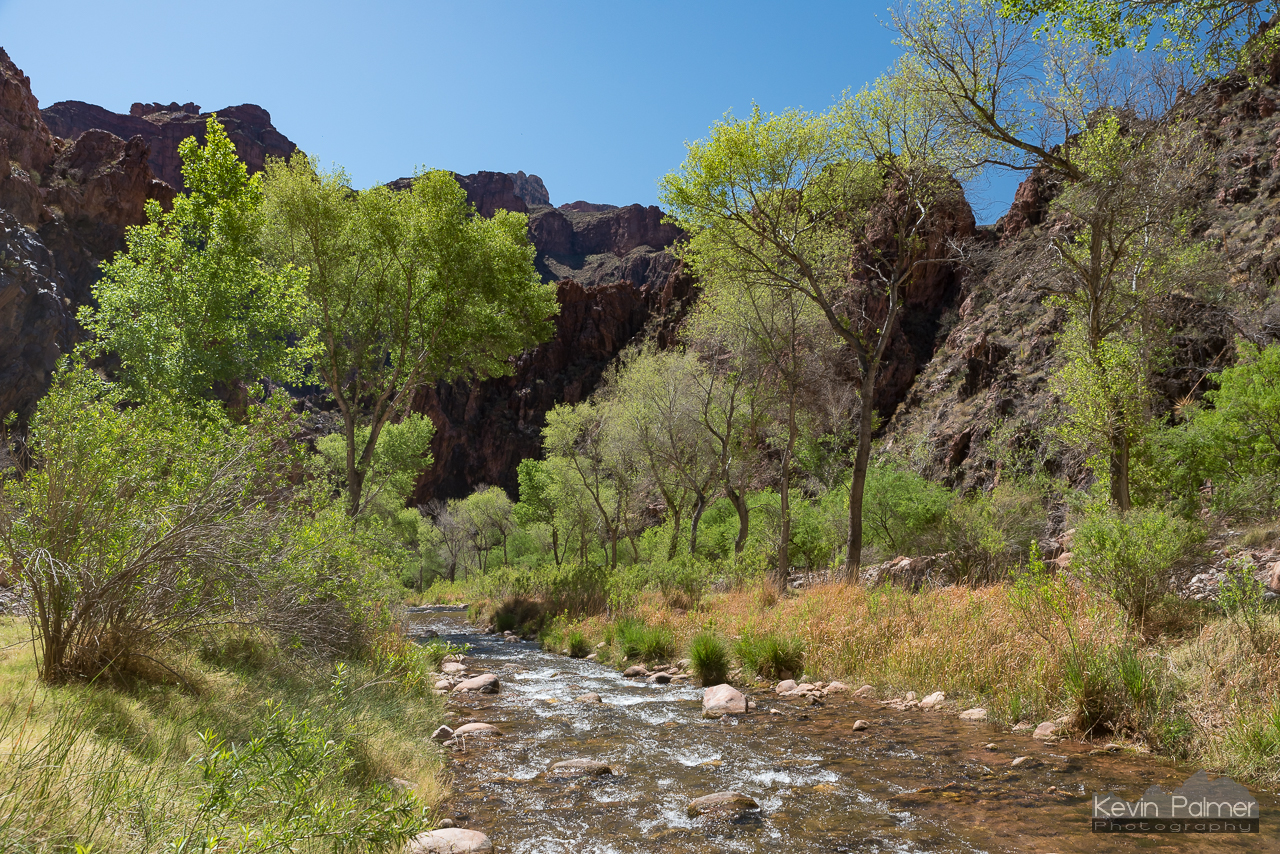
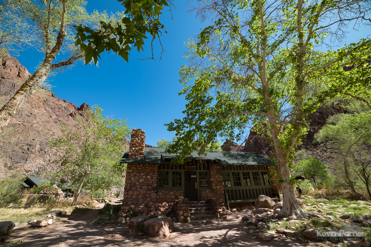
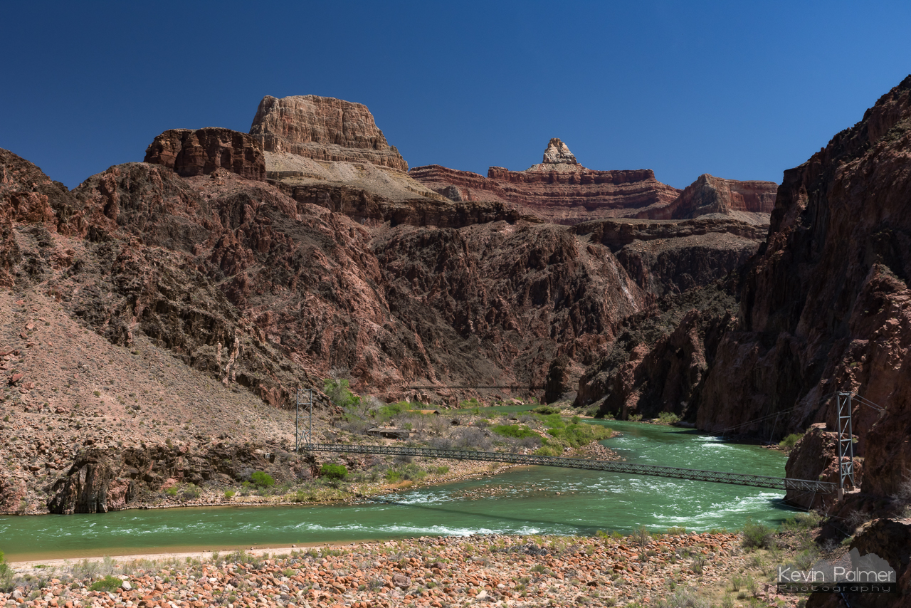
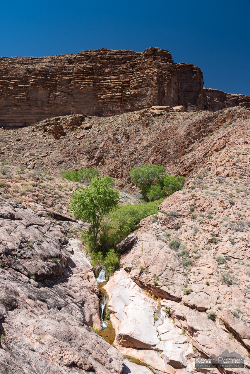
A few more switchbacks and finally I reached the first suspension bridge across the Colorado River. A little further is the junction with the North Kaibab Trail. There is also a water spigot found here for refilling water bottles. I chose to make a short detour to Phantom Ranch. The area around Bright Angel Creek is very scenic, especially with the fresh spring foliage on the trees. At the canteen, they sell sack lunches, and limited snacks and drinks. Prices are on the expensive side, because all supplies are transported by mule. But something about the remoteness and the effort required to get here made the lemonade seem extra tasty. It took me just over 3 hours to hike the 7.8 miles to the ranch. I took an extended break in the shade. The thermometer read in the mid 80’s, which was an increase of almost 60 degrees since I started hiking.
After crossing the second suspension bridge, the trail followed the river for a short while. I tried to enjoy this portion, because after leaving the river it was literally all uphill from there.

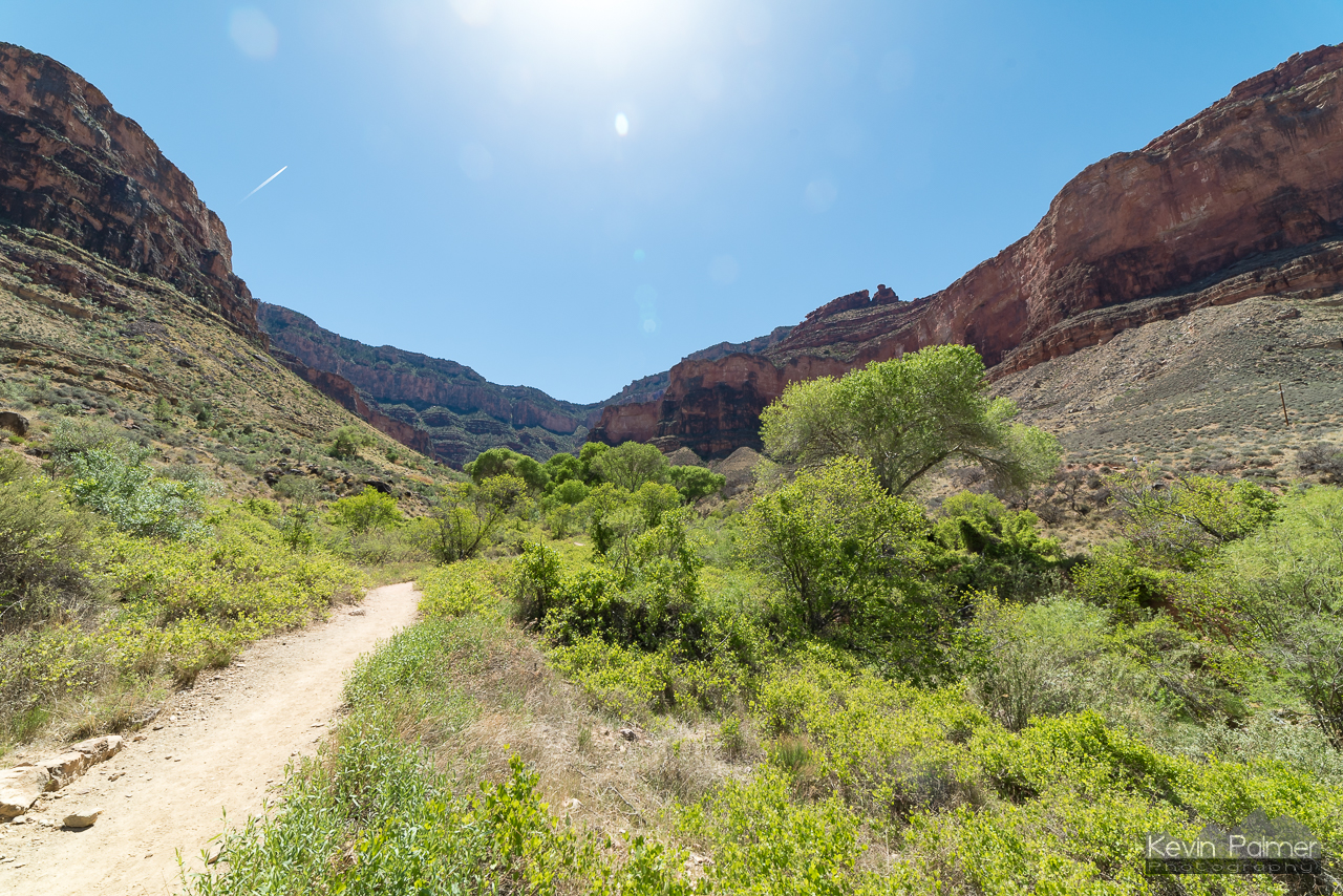
The Bright Angel Trail starts by ascending a side canyon, following Pipe Creek and then Garden Creek. After some steep switchbacks, Garden Creek Falls appears on the right. As the trail approached Indian Garden, it leveled off a little, and the environment became more lush, with an abundance of cottonwood trees. Indian Garden is where the crowds started, because it is a popular dayhike destination and has a campground. There is also another water spigot here for filling up.
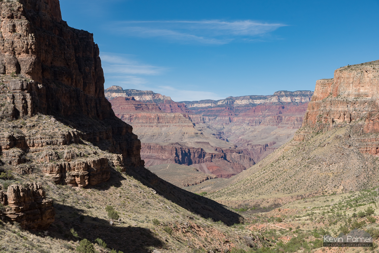
Once again I decided to take a detour. It was an extra 3 miles to reach Plateau Point, where a panoramic view of the Colorado River stretched out below. Being able to photograph the spectacular view was one reason I went there. But I also went because I wanted to add to my mileage, and push myself to the limit to find out just how far I can hike in a single day. And besides, the trail was flat so it was relatively easy.

Back at Indian Garden, the trail once again begins a steady incline. The sun disappeared behind the high walls and the temperature began to drop. The last 3 miles were the most brutal part of the hike. The switchbacks on this portion of the Bright Angel Trail are relentless. My feet were hurting, my legs were sore, and I found myself having to take short but frequent breaks. It felt like it would never end. But finally I reached the rim of the canyon, some 11 hours after I started.
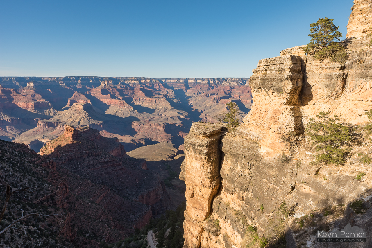
I had just enough time to grab dinner at the food court, before heading to Yavapai Point to watch the sunset. Despite all the aches and pains, dusty clothes, and sunburns, it was very satisfying to complete the longest dayhike I’ve ever done: 23.4 miles. Click here to see my hiking stats recorded on the GaiaGPS app. I’m not a super speedy hiker, and I stop frequently for pictures, so others may be faster. Detours to Phantom Ranch, Plateau Point, and various overlooks added an extra 6 miles to the total. This hike can be done in as little as 17 miles if you strictly stay on the South Kaibab and Bright Angel Trails.
A Few Tips:
- This hike is the opposite of climbing a mountain. After summiting a peak, hiking back is a lot faster and less strenuous. But hiking the Grand Canyon, the first half is relatively easy, while the second half is very hard. Keep this in mind, and allow for more time going back up.
- The South Rim is 7,000 feet above sea level. This high elevation may add extra strain for those who aren’t used to it.
- You’ll pass at least 6 outhouses along this route, use them.
- There are 2 water refill stations, near Indian Garden, and Bright Angel campground. The pipeline does occasionally break, and carrying a water filter gives you more options to fill up.
- Keep an eye on other hikers, and offer extra snacks or water to those who may need it. There are many who will hike down a ways, but are not prepared for the hike back up.
- Reserve a campsite at Mather Campground at least a few weeks in advance. They have coin-operated showers there for after the hike.